- Front Page
- Politica
- Local
- Internacional
- Deporte
- Analisis
- Investiga
- Live
- LenguahePapiamento

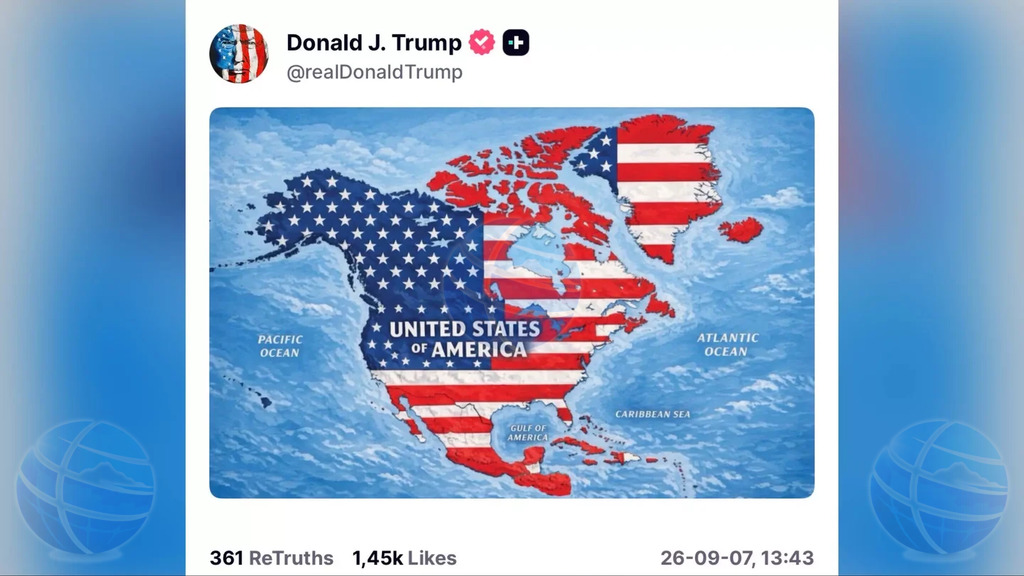
Trump shares map showing U.S. flag across much of North America and Caribbean
WASHINGTON — U.S. President Donald Trump has shared a map on Truth Social showing nearly all of North America and a large part of the Caribbean covered by the American flag, without providing any explanation.
The image places “United States of America” across the continent and depicts Canada, Mexico, Greenland, parts of Central America and numerous Caribbean islands under the Stars and Stripes. The Gulf of Mexico is labeled “Gulf of America.”
French media highlighted that French Caribbean territories including Guadeloupe, Martinique, Saint-Martin and Saint-Barthélemy also appear in U.S. colors. Cuba, Haiti, Jamaica, the Dominican Republic, the Bahamas and several Central American countries appear to be included as well.
Trump did not call for annexation, and his administration has announced no policy to incorporate the countries and territories shown. The image therefore cannot automatically be interpreted as an official territorial claim.
It does, however, echo earlier comments by Trump about Greenland and Canada, which he has previously referred to as a possible 51st U.S. state.
For Aruba, Curaçao, Bonaire, Sint Maarten, Saba and Sint Eustatius, the map is too geographically imprecise to determine whether they are individually included, although much of the Caribbean island chain appears under U.S. colors.